Geolocate

Oventeni topographic map

Click on the map to display elevation.

About this map

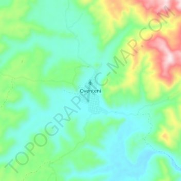
Name: Oventeni topographic map, elevation, terrain.

Location: Oventeni, Raymondi, Atalaya, Ucayali, Perú (-10.79385 -74.26100 -10.71385 -74.18100)

Average elevation: 3,638 ft

Minimum elevation: 3,153 ft

Maximum elevation: 4,970 ft

Gear up for your next adventure:

🧭Pro Hiking Compasses - High-accuracy liquid-filled compasses for topographic orientation
🗺️Topographic Maps - Detailed topo maps for hiking, exploring and outdoor navigation
🔪Outdoor Multitools - Essential survival tools for gear repair and field use
🌧️Backpack Rain Cover - Keep gear dry in wet weather
🔋Solar Power Banks - Keep your GPS and phone charged in remote wilderness areas

As an Amazon Associate, this site earns from qualifying purchases at no extra cost to you.