
Thank you for supporting this site ❤️
Make a donation
Make a donation
Gear up for your next adventure:
As an Amazon Associate, this site earns from qualifying purchases at no extra cost to you.
Grøa topographic map
Click on the map to display elevation.
Thank you for supporting this site ❤️
Make a donation
Make a donation
Gear up for your next adventure:
As an Amazon Associate, this site earns from qualifying purchases at no extra cost to you.
About this map
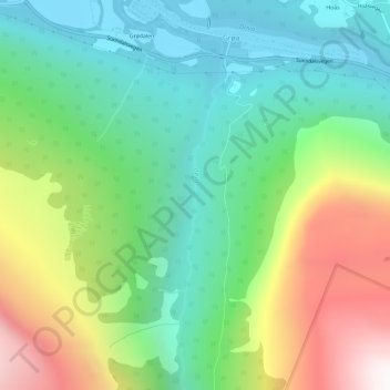
Name: Grøa topographic map, elevation, terrain.
Location: Grøa, Sunndal, Møre og Romsdal, 6612, Norway (62.62318 8.71732 62.64524 8.72397)
Average elevation: 1,673 ft
Minimum elevation: 115 ft
Maximum elevation: 4,711 ft
Thank you for supporting this site ❤️
Make a donation
Make a donation
Gear up for your next adventure:
As an Amazon Associate, this site earns from qualifying purchases at no extra cost to you.