
Make a donation
Gear up for your next adventure:
As an Amazon Associate, this site earns from qualifying purchases at no extra cost to you.
Karken topographic map
Click on the map to display elevation.
Make a donation
Gear up for your next adventure:
As an Amazon Associate, this site earns from qualifying purchases at no extra cost to you.
Karken
Die Ortschaft liegt vollständig im Tal der nordöstlich den Ort passierenden Rur, größere Höhenunterschiede sind nicht vorhanden. Der niedrigste Punkt der Ortslage mit 28 m ü. NN befindet sich nördlich des breit gelagerten Dorfes an der niederländischen Grenze.
Make a donation
Gear up for your next adventure:
As an Amazon Associate, this site earns from qualifying purchases at no extra cost to you.
About this map
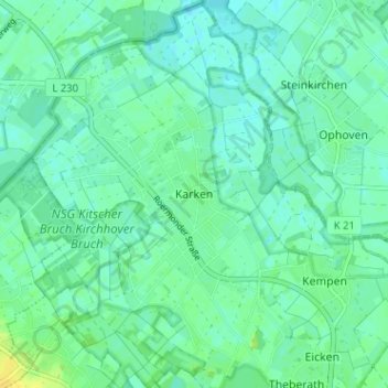
Name: Karken topographic map, elevation, terrain.
Average elevation: 112 ft
Minimum elevation: 92 ft
Maximum elevation: 154 ft
Make a donation
Gear up for your next adventure:
As an Amazon Associate, this site earns from qualifying purchases at no extra cost to you.