
Thank you for supporting this site ❤️
Make a donation
Make a donation
Gear up for your next adventure:
As an Amazon Associate, this site earns from qualifying purchases at no extra cost to you.
Kauswagan topographic map
Click on the map to display elevation.
Thank you for supporting this site ❤️
Make a donation
Make a donation
Gear up for your next adventure:
As an Amazon Associate, this site earns from qualifying purchases at no extra cost to you.
About this map
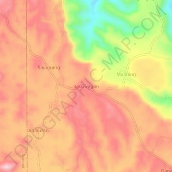
Name: Kauswagan topographic map, elevation, terrain.
Location: Kauswagan, Zamboanga del Sur, Zamboanga Peninsula, Philippines (7.99985 123.40194 8.03985 123.44194)
Average elevation: 748 ft
Minimum elevation: 141 ft
Maximum elevation: 1,089 ft
Thank you for supporting this site ❤️
Make a donation
Make a donation
Gear up for your next adventure:
As an Amazon Associate, this site earns from qualifying purchases at no extra cost to you.