
Thank you for supporting this site ❤️
Make a donation
Make a donation
Gear up for your next adventure:
As an Amazon Associate, this site earns from qualifying purchases at no extra cost to you.
Eltz topographic map
Click on the map to display elevation.
Thank you for supporting this site ❤️
Make a donation
Make a donation
Gear up for your next adventure:
As an Amazon Associate, this site earns from qualifying purchases at no extra cost to you.
About this map
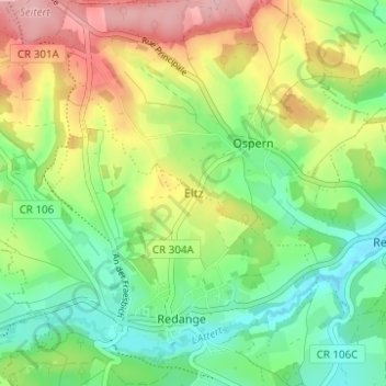
Name: Eltz topographic map, elevation, terrain.
Location: Eltz, Redange-sur-Attert, Canton Redange, 8540, Luxembourg (49.75809 5.87337 49.79809 5.91337)
Average elevation: 1,033 ft
Minimum elevation: 837 ft
Maximum elevation: 1,325 ft
Thank you for supporting this site ❤️
Make a donation
Make a donation
Gear up for your next adventure:
As an Amazon Associate, this site earns from qualifying purchases at no extra cost to you.