

Espinilla topographic map
Click on the map to display elevation.
Espinilla
Espinilla es la capital del municipio de la Hermandad de Campoo de Suso (Cantabria, España). La localidad se encuentra a 950 metros de altitud sobre el nivel del mar, y a 83 kilómetros de distancia de la capital cántabra, Santander. En el año 2012 contaba con una población de 102 habitantes (INE) La localidad se encuentra a orillas del río Híjar, origen del Ebro.
About this map
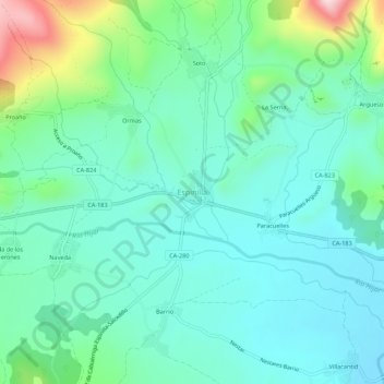
Name: Espinilla topographic map, elevation, terrain.
Average elevation: 3,182 ft
Minimum elevation: 2,907 ft
Maximum elevation: 4,131 ft
Other topographic maps
Click on a map to view its topography, its elevation and its terrain.
Barranco de las Hachas
España > Cantabria > Hermandad de Campoo de Suso > La Serna
Average elevation: 4,167 ft