
Katakeri topographic map
Interactive map
Click on the map to display elevation.
About this map
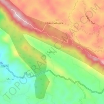
Name: Katakeri topographic map, elevation, terrain.
Location: Katakeri, Madikeri taluku, Kodagu, Karnataka, 571201, India (12.40861 75.68136 12.44861 75.72136)
Average elevation: 3,366 ft
Minimum elevation: 2,697 ft
Maximum elevation: 4,072 ft
Other topographic maps
Click on a map to view its topography, its elevation and its terrain.
Kalakeri Nidugane
India > Karnataka > Madikeri taluku > Katakeri
Kalakeri Nidugane, Katakeri, Madikeri taluku, Kodagu District, Karnataka, 571201, India
Average elevation: 3,547 ft