
Thank you for supporting this site ❤️
Make a donation
Make a donation
Gear up for your next adventure:
As an Amazon Associate, this site earns from qualifying purchases at no extra cost to you.
Ahuatepec topographic map
Click on the map to display elevation.
Thank you for supporting this site ❤️
Make a donation
Make a donation
Gear up for your next adventure:
As an Amazon Associate, this site earns from qualifying purchases at no extra cost to you.
About this map
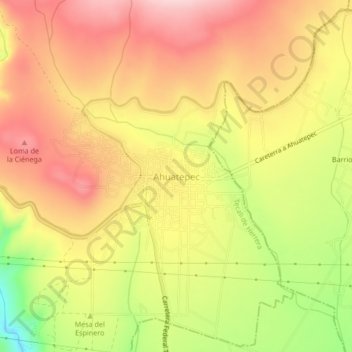
Name: Ahuatepec topographic map, elevation, terrain.
Location: Ahuatepec, Tecali de Herrera, Puebla, 75201, México (18.83917 -97.93556 18.87917 -97.89556)
Average elevation: 6,581 ft
Minimum elevation: 6,152 ft
Maximum elevation: 6,870 ft
Thank you for supporting this site ❤️
Make a donation
Make a donation
Gear up for your next adventure:
As an Amazon Associate, this site earns from qualifying purchases at no extra cost to you.