Geolocate

Nida topographic map

Click on the map to display elevation.

About this map

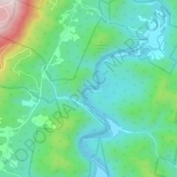
Name: Nida topographic map, elevation, terrain.

Location: Nida, Pocahontas County, West Virginia, United States (38.44206 -79.89673 38.48206 -79.85673)

Average elevation: 2,986 ft

Minimum elevation: 2,503 ft

Maximum elevation: 4,416 ft

Pocahontas County trails, hiking, mountain biking, running and outdoor activities

Gear up for your next adventure:

👟Men's Trail Runners - Lightweight footwear for fast-paced exploration and light hiking
🛌Ultralight Sleeping Bags - Compact down bags for cold nights in the wilderness
📱Heavy-Duty Phone Cases - Drop-proof and waterproof protection for outdoor navigation
📚USA Hiking Guide Books - Top trail guides and map books
📡GPS Antenna Upgrade - Enhance GPS reception in remote terrain

As an Amazon Associate, this site earns from qualifying purchases at no extra cost to you.