Geolocate

Dion topographic map

Click on the map to display elevation.

About this map

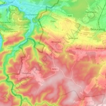
Name: Dion topographic map, elevation, terrain.

Location: Dion, Beauraing, Dinant, Namur, Wallonie, Belgique (50.03666 4.86695 50.13802 4.92310)

Average elevation: 840 ft

Minimum elevation: 318 ft

Maximum elevation: 1,270 ft

Gear up for your next adventure:

📷Action Camera - Capture your outdoor adventures in HD
🚪Portable Camp Chair - Foldable chair for comfort at camp
🛡️Bear Spray Outdoor - Protection in bear country hikes
🩳Quick‑Dry Hiking Shorts - Comfortable and quick‑dry shorts for summer hiking
🧯Portable Fire Pit - Compact fire pit for camping spots

As an Amazon Associate, this site earns from qualifying purchases at no extra cost to you.