
Make a donation
Gear up for your next adventure:
As an Amazon Associate, this site earns from qualifying purchases at no extra cost to you.
Kimberley topographic map
Click on the map to display elevation.
Make a donation
Gear up for your next adventure:
As an Amazon Associate, this site earns from qualifying purchases at no extra cost to you.
Kimberley
Kimberley is set in a relatively flat landscape with no prominent topographic features within the urban limits. The only "hills" are debris dumps generated by more than a century of diamond mining. From the 1990s these were being recycled and poured back into De Beers Mine (by 2010 it was filled to within a few tens of metres of the surface). Certain of the mine dumps, in the vicinity of the Big Hole, have been proclaimed as heritage features and are to be preserved as part of the historic industrial landscape of Kimberley.
Make a donation
Gear up for your next adventure:
As an Amazon Associate, this site earns from qualifying purchases at no extra cost to you.
About this map
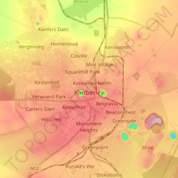
Name: Kimberley topographic map, elevation, terrain.
Average elevation: 3,947 ft
Minimum elevation: 3,530 ft
Maximum elevation: 4,209 ft
Make a donation
Gear up for your next adventure:
As an Amazon Associate, this site earns from qualifying purchases at no extra cost to you.
Other topographic maps
Click on a map to view its topography, its elevation and its terrain.
Windsorton Road
South Africa > Northern Cape > Frances Baard District Municipality > Magareng Local Municipality > Windsorton Road
Average elevation: 3,875 ft
Sol Plaatje Ward 1
South Africa > Northern Cape > Frances Baard District Municipality > Sol Plaatje Local Municipality
Average elevation: 3,776 ft