
Thank you for supporting this site ❤️
Make a donation
Make a donation
Gear up for your next adventure:
As an Amazon Associate, this site earns from qualifying purchases at no extra cost to you.
Tibetan Plateau topographic map
Click on the map to display elevation.
Thank you for supporting this site ❤️
Make a donation
Make a donation
Gear up for your next adventure:
As an Amazon Associate, this site earns from qualifying purchases at no extra cost to you.
About this map
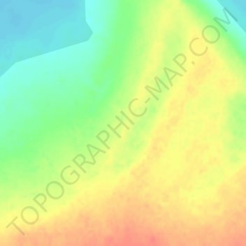
Name: Tibetan Plateau topographic map, elevation, terrain.
Location: Tibetan Plateau, 尼玛镇, Nyima County, Tibet, China (31.82803 87.40638 31.82813 87.40648)
Average elevation: 14,757 ft
Minimum elevation: 14,672 ft
Maximum elevation: 14,829 ft
Thank you for supporting this site ❤️
Make a donation
Make a donation
Gear up for your next adventure:
As an Amazon Associate, this site earns from qualifying purchases at no extra cost to you.