
Thank you for supporting this site ❤️
Make a donation
Make a donation
Gear up for your next adventure:
As an Amazon Associate, this site earns from qualifying purchases at no extra cost to you.
Kempten topographic map
Click on the map to display elevation.
Thank you for supporting this site ❤️
Make a donation
Make a donation
Gear up for your next adventure:
As an Amazon Associate, this site earns from qualifying purchases at no extra cost to you.
About this map
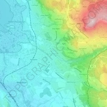
Name: Kempten topographic map, elevation, terrain.
Location: Kempten, Wetzikon, Bezirk Hinwil, Zürich, 8623, Schweiz (47.31350 8.79568 47.35350 8.83568)
Average elevation: 2,018 ft
Minimum elevation: 1,722 ft
Maximum elevation: 2,844 ft
Thank you for supporting this site ❤️
Make a donation
Make a donation
Gear up for your next adventure:
As an Amazon Associate, this site earns from qualifying purchases at no extra cost to you.