Geolocate

Grand Ridge topographic map

Click on the map to display elevation.

About this map

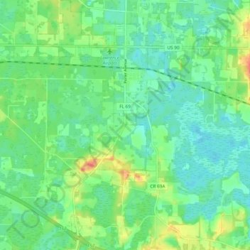
Name: Grand Ridge topographic map, elevation, terrain.

Location: Grand Ridge, Jackson County, Florida, United States (30.65310 -85.05358 30.73424 -84.98514)

Average elevation: 141 ft

Minimum elevation: 85 ft

Maximum elevation: 266 ft

Jackson County trails, hiking, mountain biking, running and outdoor activities

Other topographic maps

Click on a map to view its topography, its elevation and its terrain.

Compass Lake

United States > Florida > Jackson County

Average elevation: 217 ft

Haynes

United States > Florida > Jackson County > Haynes

Average elevation: 92 ft

Cypress

United States > Florida > Jackson County > Cypress

Average elevation: 135 ft

Gear up for your next adventure:

👟Men's Trail Runners - Lightweight footwear for fast-paced exploration and light hiking
🌐World Map Poster - Decorative world maps with topographic info
📡GPS Antenna Upgrade - Enhance GPS reception in remote terrain
🧢Sun Protection Hats - Wide-brimmed and UPF-rated hats for high-altitude sun safety
🛰️Handheld GPS Units - Professional satellite navigators for precise backcountry mapping

As an Amazon Associate, this site earns from qualifying purchases at no extra cost to you.