
Flawil topographic map
Interactive map
Click on the map to display elevation.
About this map
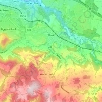
Name: Flawil topographic map, elevation, terrain.
Location: Flawil, Wahlkreis Wil, Saint-Gall, Suisse (47.38442 9.15612 47.42849 9.23315)
Average elevation: 2,277 ft
Minimum elevation: 1,722 ft
Maximum elevation: 2,986 ft
Other topographic maps
Click on a map to view its topography, its elevation and its terrain.
Degersheim
Suisse > Saint-Gall > Wahlkreis Wil
Degersheim, Wahlkreis Wil, Saint-Gall, 9113, Suisse
Average elevation: 2,618 ft
Uzwil
Suisse > Saint-Gall > Wahlkreis Wil
Uzwil, Wahlkreis Wil, Saint-Gall, Suisse
Average elevation: 1,873 ft