
Thank you for supporting this site ❤️
Make a donation
Make a donation
Gear up for your next adventure:
As an Amazon Associate, this site earns from qualifying purchases at no extra cost to you.
Peio topographic map
Click on the map to display elevation.
Thank you for supporting this site ❤️
Make a donation
Make a donation
Gear up for your next adventure:
As an Amazon Associate, this site earns from qualifying purchases at no extra cost to you.
About this map
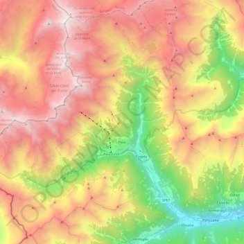
Name: Peio topographic map, elevation, terrain.
Average elevation: 7,694 ft
Minimum elevation: 2,940 ft
Maximum elevation: 12,238 ft
Thank you for supporting this site ❤️
Make a donation
Make a donation
Gear up for your next adventure:
As an Amazon Associate, this site earns from qualifying purchases at no extra cost to you.
Other topographic maps
Click on a map to view its topography, its elevation and its terrain.
La Camosciara
Italy > Trentino – Alto Adige/Südtirol > Provincia di Trento > Vallelaghi > Monte Terlago
Average elevation: 3,281 ft