Geolocate

Prairie du Rocher topographic map

Click on the map to display elevation.

About this map

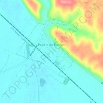
Name: Prairie du Rocher topographic map, elevation, terrain.

Location: Prairie du Rocher, Randolph County, Illinois, United States (38.07271 -90.10775 38.08987 -90.08846)

Average elevation: 443 ft

Minimum elevation: 361 ft

Maximum elevation: 673 ft

Randolph County trails, hiking, mountain biking, running and outdoor activities

Other topographic maps

Click on a map to view its topography, its elevation and its terrain.

Marigold

United States > Illinois > Randolph County

Average elevation: 522 ft

Chester

United States > Illinois > Randolph County > Chester

Average elevation: 469 ft

Gear up for your next adventure:

🎁Geography Themed Gifts - Unique gift ideas for map lovers and geography enthusiasts
🔥Plasma Lighters - Windproof lighters that work in any weather condition
🪶Camping Sleeping Pad - Comfortable sleeping pad for backpacking
🪶Camp Gear Gift Set - Perfect gift bundle for outdoor fans
🗺️NatGeo Topo Maps - High-quality waterproof printed topographic maps of US Parks

As an Amazon Associate, this site earns from qualifying purchases at no extra cost to you.