Geolocate

Winslow topographic map

Click on the map to display elevation.

About this map

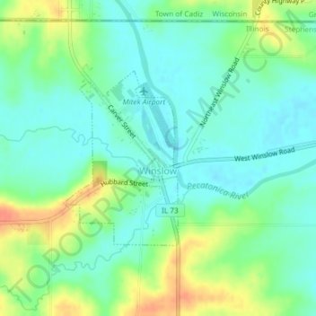
Name: Winslow topographic map, elevation, terrain.

Location: Winslow, Stephenson County, Illinois, United States (42.48629 -89.80275 42.50125 -89.78950)

Average elevation: 810 ft

Minimum elevation: 761 ft

Maximum elevation: 906 ft

Stephenson County trails, hiking, mountain biking, running and outdoor activities

Gear up for your next adventure:

🔥Fast-Boil Camping Stoves - Efficient cooking systems for quick trail meals
📌Outdoor GPS Map App - Apps and devices for digital topographic navigation
🎒Gear Packing Cubes - Organize your backpack efficiently
🥇GPS Hiking Watch - Multi‑sport GPS watch with navigation and trail tracking
📱Solar Portable Charger - Solar power bank for charging devices off‑grid

As an Amazon Associate, this site earns from qualifying purchases at no extra cost to you.