
Mohonk Mountain House Property topographic map
Interactive map
Click on the map to display elevation.
About this map
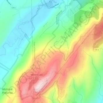
Name: Mohonk Mountain House Property topographic map, elevation, terrain.
Average elevation: 748 ft
Minimum elevation: 233 ft
Maximum elevation: 1,503 ft
Other topographic maps
Click on a map to view its topography, its elevation and its terrain.
Stone Ridge
United States > New York > Ulster County > Town of Marbletown
Stone Ridge, Town of Marbletown, Ulster County, New York, United States
Average elevation: 305 ft
The Vly
United States > New York > Ulster County > Town of Marbletown
The Vly, Town of Marbletown, Ulster County, New York, 12484, United States
Average elevation: 833 ft
High Falls
United States > New York > Ulster County > Town of Marbletown
High Falls, Town of Marbletown, Ulster County, New York, United States
Average elevation: 253 ft