Geolocate

Joppa topographic map

Click on the map to display elevation.

About this map

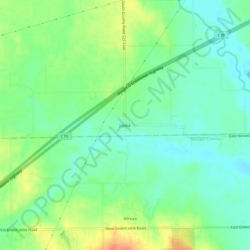
Name: Joppa topographic map, elevation, terrain.

Location: Joppa, Hendricks County, Indiana, United States (39.61227 -86.45222 39.65227 -86.41222)

Average elevation: 738 ft

Minimum elevation: 679 ft

Maximum elevation: 843 ft

Hendricks County trails, hiking, mountain biking, running and outdoor activities

Other topographic maps

Click on a map to view its topography, its elevation and its terrain.

North Salem

United States > Indiana > Hendricks County

Average elevation: 912 ft

Stilesville

United States > Indiana > Hendricks County

Average elevation: 787 ft

Coatesville

United States > Indiana > Hendricks County

Average elevation: 889 ft

Pittsboro

United States > Indiana > Hendricks County

Average elevation: 935 ft

Amo

United States > Indiana > Hendricks County

Average elevation: 837 ft

Avon

United States > Indiana > Hendricks County

Average elevation: 833 ft

Danville

United States > Indiana > Hendricks County

Average elevation: 922 ft

Clayton

United States > Indiana > Hendricks County

Average elevation: 863 ft

Lizton

United States > Indiana > Hendricks County

Average elevation: 958 ft

Gear up for your next adventure:

🧷Carabiner Set - Durable clips for gear attachment
🪶Camping Sleeping Pad - Comfortable sleeping pad for backpacking
🏕️Tent Footprint - Protect your tent base from wear
🔦Compact Flashlight - Reliable flashlight for emergencies
🎒Outdoor Daypacks - Lightweight backpacks designed for carrying maps and essential gear

As an Amazon Associate, this site earns from qualifying purchases at no extra cost to you.