
三余镇 topographic map
Interactive map
Click on the map to display elevation.
About this map
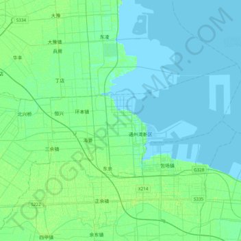
Name: 三余镇 topographic map, elevation, terrain.
Location: 三余镇, 通州区, 南通市, 江苏省, 226300, 中国 (32.09238 121.20379 32.24372 121.58535)
Average elevation: 10 ft
Minimum elevation: -7 ft
Maximum elevation: 26 ft
Other topographic maps
Click on a map to view its topography, its elevation and its terrain.