Geolocate

Spencer topographic map

Click on the map to display elevation.

About this map

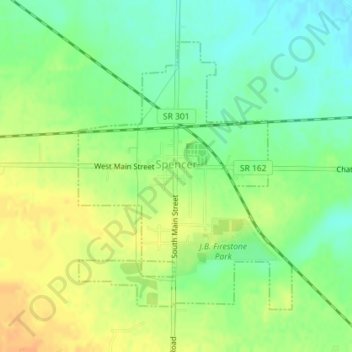
Name: Spencer topographic map, elevation, terrain.

Location: Spencer, Medina County, Ohio, United States (41.08914 -82.13321 41.10970 -82.11141)

Average elevation: 912 ft

Minimum elevation: 860 ft

Maximum elevation: 968 ft

Medina County trails, hiking, mountain biking, running and outdoor activities

Other topographic maps

Click on a map to view its topography, its elevation and its terrain.

Homerville

United States > Ohio > Medina County

Average elevation: 1,083 ft

Valley City Station

United States > Ohio > Medina County

Average elevation: 896 ft

Reeds Hill

United States > Ohio > Medina County

Average elevation: 1,083 ft

Chippewa Lake Park

United States > Ohio > Medina County > Medina

Average elevation: 1,053 ft

Wordens Ledges

United States > Ohio > Medina County

Average elevation: 1,083 ft

River Corners

United States > Ohio > Medina County

Average elevation: 879 ft

South Pond

United States > Ohio > Medina County

Average elevation: 1,119 ft

Gear up for your next adventure:

🔋Solar Power Banks - Keep your GPS and phone charged in remote wilderness areas
👖Convertible Hiking Pants - Versatile zip-off pants for changing altitudes and temperatures
🚗GPS Dash Cams - Record your scenic drives through mountain passes and canyons
📱Solar Portable Charger - Solar power bank for charging devices off‑grid
🔌USB Car Charger - Car charger for on‑the‑go power needs

As an Amazon Associate, this site earns from qualifying purchases at no extra cost to you.