
Menominee topographic map
Click on the map to display elevation.
About this map
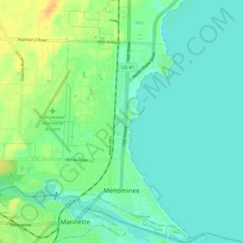
Name: Menominee topographic map, elevation, terrain.
Location: Menominee, Menominee County, Michigan, United States (45.09476 -87.66448 45.15461 -87.58587)
Average elevation: 594 ft
Minimum elevation: 564 ft
Maximum elevation: 656 ft
Menominee County trails, hiking, mountain biking, running and outdoor activities
Other topographic maps
Click on a map to view its topography, its elevation and its terrain.