Geolocate

Taylor topographic map

Click on the map to display elevation.

About this map
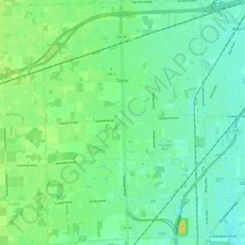
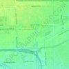
Name: Taylor topographic map, elevation, terrain.

Location: Taylor, Wayne County, Michigan, 48180, United States (42.18128 -83.30900 42.26989 -83.22814)

Average elevation: 617 ft

Minimum elevation: 587 ft

Maximum elevation: 669 ft

Wayne County trails, hiking, mountain biking, running and outdoor activities

Other topographic maps

Click on a map to view its topography, its elevation and its terrain.
Perrinville

United States > Michigan > Wayne County > Westland

Average elevation: 640 ft

Palmer Park

United States > Michigan > Wayne County > Detroit

Average elevation: 650 ft

Sunnyside

United States > Michigan > Wayne County > Romulus

Average elevation: 636 ft

Elm

United States > Michigan > Wayne County > Livonia

Average elevation: 640 ft

Calvert Park

United States > Michigan > Wayne County > Detroit

Average elevation: 643 ft

Newburg

United States > Michigan > Wayne County > Livonia

Average elevation: 686 ft

Gear up for your next adventure:

👟Men's Trail Runners - Lightweight footwear for fast-paced exploration and light hiking
🔥Plasma Lighters - Windproof lighters that work in any weather condition
🌐World Map Poster - Decorative world maps with topographic info
🔋Solar Power Banks - Keep your GPS and phone charged in remote wilderness areas
🪶Compact Camp Shovel - Folding shovel for campsite tasks

As an Amazon Associate, this site earns from qualifying purchases at no extra cost to you.