
Thank you for supporting this site ❤️
Make a donation
Make a donation
Gear up for your next adventure:
As an Amazon Associate, this site earns from qualifying purchases at no extra cost to you.
Du Già topographic map
Click on the map to display elevation.
Thank you for supporting this site ❤️
Make a donation
Make a donation
Gear up for your next adventure:
As an Amazon Associate, this site earns from qualifying purchases at no extra cost to you.
About this map
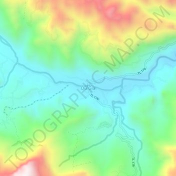
Name: Du Già topographic map, elevation, terrain.
Location: Du Già, Yên Minh District, Hà Giang Province, 20318, Vietnam (22.91117 105.20291 22.95117 105.24291)
Average elevation: 2,149 ft
Minimum elevation: 1,230 ft
Maximum elevation: 4,124 ft
Thank you for supporting this site ❤️
Make a donation
Make a donation
Gear up for your next adventure:
As an Amazon Associate, this site earns from qualifying purchases at no extra cost to you.