Geolocate

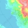
Mompox topographic map

Click on the map to display elevation.

About this map

Name: Mompox topographic map, elevation, terrain.

Location: Mompox, Cordillera Department, Región Oriental, Paraguay (-25.24142 -56.97658 -25.23255 -56.96635)

Average elevation: 430 ft

Minimum elevation: 331 ft

Maximum elevation: 604 ft

Other topographic maps

Click on a map to view its topography, its elevation and its terrain.
Caacupé

Paraguay > Cordillera Department

Average elevation: 686 ft

San Bernardino

Paraguay > Cordillera Department

Average elevation: 341 ft

Caacupé

Paraguay > Cordillera Department

Average elevation: 686 ft

Tobatí

Paraguay > Cordillera Department

Average elevation: 381 ft

San Bernardino

Paraguay > Cordillera Department

Average elevation: 341 ft

Juan de Mena

Paraguay > Cordillera Department

Average elevation: 259 ft

Potrero Poi

Paraguay > Cordillera Department

Average elevation: 794 ft

Gear up for your next adventure:

🥇GPS Hiking Watch - Multi‑sport GPS watch with navigation and trail tracking
📡GPS Antenna Upgrade - Enhance GPS reception in remote terrain
🧭Map Reading Tools - Tools and kits for map navigation
⌚Solar GPS Watches - Advanced multisport watches with built-in topographic maps
🪶Compact Camp Shovel - Folding shovel for campsite tasks

As an Amazon Associate, this site earns from qualifying purchases at no extra cost to you.