
Định Quán topographic map
Interactive map
Click on the map to display elevation.
About this map
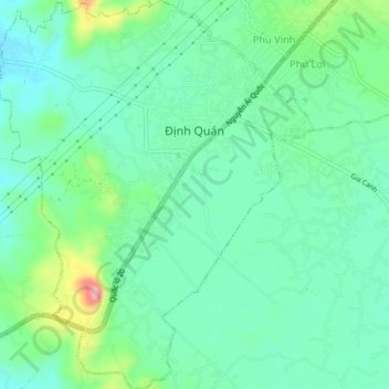
Name: Định Quán topographic map, elevation, terrain.
Location: Định Quán, Định Quán District, Đồng Nai Province, Vietnam (11.17116 107.33076 11.21280 107.36524)
Average elevation: 463 ft
Minimum elevation: 341 ft
Maximum elevation: 794 ft
Other topographic maps
Click on a map to view its topography, its elevation and its terrain.
Xã Thanh Sơn
Vietnam > Dong Nai province > Định Quán District
Xã Thanh Sơn, Định Quán District, Đồng Nai Province, Vietnam
Average elevation: 410 ft