Geolocate

Sargiguda topographic map

Click on the map to display elevation.

About this map

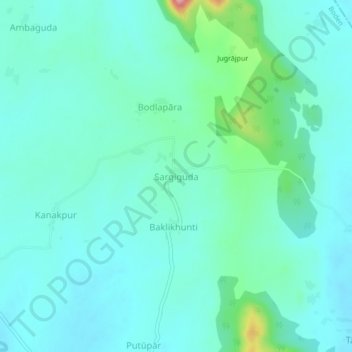
Name: Sargiguda topographic map, elevation, terrain.

Location: Sargiguda, Boden, Nuapada District, Odisha, 766111, India (20.20683 82.59478 20.24683 82.63478)

Average elevation: 968 ft

Minimum elevation: 876 ft

Maximum elevation: 1,407 ft

Gear up for your next adventure:

🧭Outdoor Navigation Book - Learn advanced navigation skills
🪓Survival Multi‑Tool - Versatile tool for camp and trail tasks
🪶Compact Camp Shovel - Folding shovel for campsite tasks
📶Satellite Messenger - Communication device off‑grid
🪶Camp Gear Gift Set - Perfect gift bundle for outdoor fans

As an Amazon Associate, this site earns from qualifying purchases at no extra cost to you.