Geolocate

Mount Helena topographic map

Click on the map to display elevation.

About this map

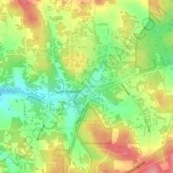
Name: Mount Helena topographic map, elevation, terrain.

Location: Mount Helena, Western Australia, 6073, Australia (-31.89788 116.18935 -31.85788 116.22935)

Average elevation: 981 ft

Minimum elevation: 804 ft

Maximum elevation: 1,181 ft

Gear up for your next adventure:

🥤Water Filter Bottle - All‑in‑one filter bottle for safe hydration
🧺Microfiber Travel Towels - Compact and fast-drying towels for trail use
🎒Hydration Pack - Hands‑free water reservoir for long hikes
🔊Portable Camp Speaker - Music and alerts at camp
🧭Map Reading Tools - Tools and kits for map navigation

As an Amazon Associate, this site earns from qualifying purchases at no extra cost to you.