
Thank you for supporting this site ❤️
Make a donation
Make a donation
Gear up for your next adventure:
As an Amazon Associate, this site earns from qualifying purchases at no extra cost to you.
Jolfa topographic map
Click on the map to display elevation.
Thank you for supporting this site ❤️
Make a donation
Make a donation
Gear up for your next adventure:
As an Amazon Associate, this site earns from qualifying purchases at no extra cost to you.
About this map
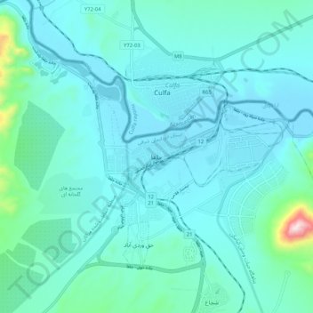
Name: Jolfa topographic map, elevation, terrain.
Location: Jolfa, دهستان شجاع, بخش مرکزی, Jolfa County, Iran (38.89761 45.58521 38.97761 45.66521)
Average elevation: 2,510 ft
Minimum elevation: 2,283 ft
Maximum elevation: 4,216 ft
Thank you for supporting this site ❤️
Make a donation
Make a donation
Gear up for your next adventure:
As an Amazon Associate, this site earns from qualifying purchases at no extra cost to you.