
Thank you for supporting this site ❤️
Make a donation
Make a donation
Gear up for your next adventure:
As an Amazon Associate, this site earns from qualifying purchases at no extra cost to you.
Pronojiwo topographic map
Click on the map to display elevation.
Thank you for supporting this site ❤️
Make a donation
Make a donation
Gear up for your next adventure:
As an Amazon Associate, this site earns from qualifying purchases at no extra cost to you.
About this map
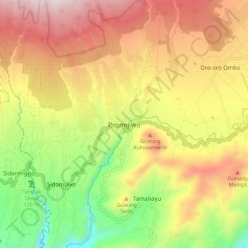
Name: Pronojiwo topographic map, elevation, terrain.
Location: Pronojiwo, Lumajang, East Java, Java, 67374, Indonesia (-8.25090 112.90682 -8.17090 112.98682)
Average elevation: 2,365 ft
Minimum elevation: 801 ft
Maximum elevation: 3,878 ft
Thank you for supporting this site ❤️
Make a donation
Make a donation
Gear up for your next adventure:
As an Amazon Associate, this site earns from qualifying purchases at no extra cost to you.