
Make a donation
Gear up for your next adventure:
As an Amazon Associate, this site earns from qualifying purchases at no extra cost to you.
Ojo de Agua topographic map
Click on the map to display elevation.
Make a donation
Gear up for your next adventure:
As an Amazon Associate, this site earns from qualifying purchases at no extra cost to you.
Ojo de Agua
Ojo de Agua is the largest colonia in the municipality of Tecámac in State of Mexico, Mexico. It is located in the northeastern part of the state, northeast of Mexico City and within the Greater Mexico City urban area. It had a 2010 census population of 242,272 inhabitants, or 66.45 percent of its municipality's total of 364,579. Ojo de Agua is the largest locality in Mexico that is not a municipal seat. (The municipal seat lies in the town of Tecámac de Felipe Villanueva, with a population of 15,911 inhabitants.) Ojo de Agua lies at an elevation of 2,248 m (7,375 ft.) above sea level.
Make a donation
Gear up for your next adventure:
As an Amazon Associate, this site earns from qualifying purchases at no extra cost to you.
About this map
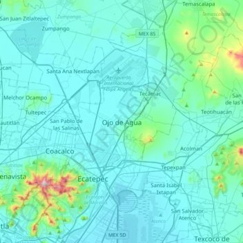
Name: Ojo de Agua topographic map, elevation, terrain.
Location: Ojo de Agua, Tecámac, State of Mexico, 55770, Mexico (19.51447 -99.16809 19.83447 -98.84809)
Average elevation: 7,536 ft
Minimum elevation: 7,300 ft
Maximum elevation: 9,810 ft
Make a donation
Gear up for your next adventure:
As an Amazon Associate, this site earns from qualifying purchases at no extra cost to you.