
前郭尔罗斯蒙古族自治县 topographic map
Interactive map
Click on the map to display elevation.
About this map
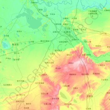
Name: 前郭尔罗斯蒙古族自治县 topographic map, elevation, terrain.
Location: 前郭尔罗斯蒙古族自治县, 松原市, 吉林省, 中国 (44.29889 123.61009 45.45673 125.30637)
Average elevation: 548 ft
Minimum elevation: 394 ft
Maximum elevation: 958 ft
Other topographic maps
Click on a map to view its topography, its elevation and its terrain.