
扶余市 topographic map
Interactive map
Click on the map to display elevation.
About this map
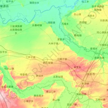
Name: 扶余市 topographic map, elevation, terrain.
Location: 扶余市, 松原市, 吉林省, 中国 (44.75968 124.98968 45.51969 126.19089)
Average elevation: 535 ft
Minimum elevation: 390 ft
Maximum elevation: 948 ft
Other topographic maps
Click on a map to view its topography, its elevation and its terrain.