
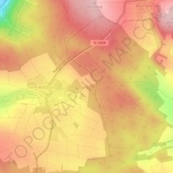
Brückenfundamentloch Reichsautobahn Strecke 46, Fulda-Würzburg topographic map
Interactive map
Click on the map to display elevation.
About this map
Name: Brückenfundamentloch Reichsautobahn Strecke 46, Fulda-Würzburg topographic map, elevation, terrain.
Average elevation: 1,007 ft
Minimum elevation: 528 ft
Maximum elevation: 1,243 ft