
大洼区 topographic map
Interactive map
Click on the map to display elevation.
About this map
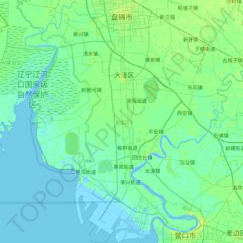
Name: 大洼区 topographic map, elevation, terrain.
Location: 大洼区, 盘锦市, 辽宁省, 中国 (40.65766 121.80633 41.14891 122.36043)
Average elevation: 10 ft
Minimum elevation: -7 ft
Maximum elevation: 33 ft
Other topographic maps
Click on a map to view its topography, its elevation and its terrain.