
Thank you for supporting this site ❤️
Make a donation
Make a donation
Gear up for your next adventure:
As an Amazon Associate, this site earns from qualifying purchases at no extra cost to you.
Mazur topographic map
Click on the map to display elevation.
Thank you for supporting this site ❤️
Make a donation
Make a donation
Gear up for your next adventure:
As an Amazon Associate, this site earns from qualifying purchases at no extra cost to you.
About this map
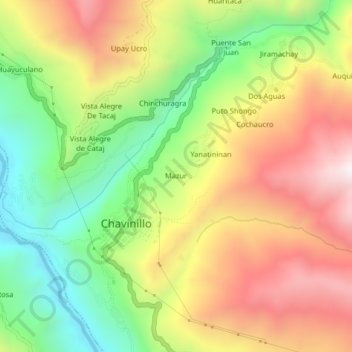
Name: Mazur topographic map, elevation, terrain.
Location: Mazur, Chavinillo, Province of Yarowilca, Huánuco, Peru (-9.87332 -76.62261 -9.83332 -76.58261)
Average elevation: 11,759 ft
Minimum elevation: 10,203 ft
Maximum elevation: 13,455 ft
Thank you for supporting this site ❤️
Make a donation
Make a donation
Gear up for your next adventure:
As an Amazon Associate, this site earns from qualifying purchases at no extra cost to you.