
Make a donation
Gear up for your next adventure:
As an Amazon Associate, this site earns from qualifying purchases at no extra cost to you.
Sulphur Mountain topographic map
Click on the map to display elevation.
Make a donation
Gear up for your next adventure:
As an Amazon Associate, this site earns from qualifying purchases at no extra cost to you.
About this map
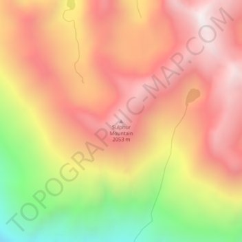
Name: Sulphur Mountain topographic map, elevation, terrain.
Average elevation: 5,341 ft
Minimum elevation: 2,776 ft
Maximum elevation: 7,031 ft
Make a donation
Gear up for your next adventure:
As an Amazon Associate, this site earns from qualifying purchases at no extra cost to you.
Other topographic maps
Click on a map to view its topography, its elevation and its terrain.
Marysville
United States > Washington > Snohomish County
The city's topography varies from the low-lying downtown, located along the banks of Ebey Slough 5 feet (1.5 m) above sea level, rising to 160 feet (49 m) near Smokey Point and over 465 feet (142 m) in the eastern highlands. Marysville sits in the watershed of two major creeks, Quilceda Creek and Allen Creek,…
Average elevation: 236 ft
Make a donation
Gear up for your next adventure:
As an Amazon Associate, this site earns from qualifying purchases at no extra cost to you.