
Make a donation
Gear up for your next adventure:
As an Amazon Associate, this site earns from qualifying purchases at no extra cost to you.
Monticello topographic map
Click on the map to display elevation.
Make a donation
Gear up for your next adventure:
As an Amazon Associate, this site earns from qualifying purchases at no extra cost to you.
About this map
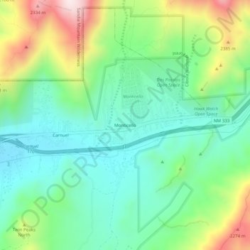
Name: Monticello topographic map, elevation, terrain.
Location: Monticello, Bernalillo County, New Mexico, United States (35.04530 -106.46464 35.08530 -106.42464)
Average elevation: 6,394 ft
Minimum elevation: 5,732 ft
Maximum elevation: 7,835 ft
Bernalillo County trails, hiking, mountain biking, running and outdoor activities
Make a donation
Gear up for your next adventure:
As an Amazon Associate, this site earns from qualifying purchases at no extra cost to you.
Other topographic maps
Click on a map to view its topography, its elevation and its terrain.
Joe M. Lucero Hillside
United States > New Mexico > Bernalillo County > Albuquerque
Average elevation: 5,371 ft