
Thank you for supporting this site ❤️
Make a donation
Make a donation
Gear up for your next adventure:
As an Amazon Associate, this site earns from qualifying purchases at no extra cost to you.
Castroañe topographic map
Click on the map to display elevation.
Thank you for supporting this site ❤️
Make a donation
Make a donation
Gear up for your next adventure:
As an Amazon Associate, this site earns from qualifying purchases at no extra cost to you.
About this map
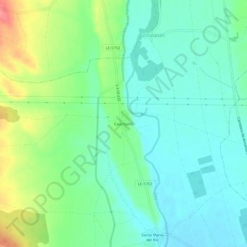
Name: Castroañe topographic map, elevation, terrain.
Location: Castroañe, Villaselán, León, Castile and León, 24344, Spain (42.52669 -5.07410 42.56669 -5.03410)
Average elevation: 2,864 ft
Minimum elevation: 2,782 ft
Maximum elevation: 3,054 ft
Thank you for supporting this site ❤️
Make a donation
Make a donation
Gear up for your next adventure:
As an Amazon Associate, this site earns from qualifying purchases at no extra cost to you.