
Mari Indus topographic map
Interactive map
Click on the map to display elevation.
About this map
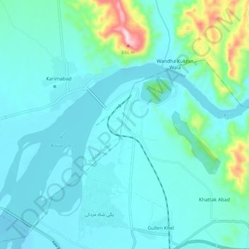
Name: Mari Indus topographic map, elevation, terrain.
Location: Mari Indus, Punjab, Pakistan (32.90845 71.52303 32.98845 71.60303)
Average elevation: 876 ft
Minimum elevation: 656 ft
Maximum elevation: 2,182 ft
Other topographic maps
Click on a map to view its topography, its elevation and its terrain.