
Les Giettes topographic map
Interactive map
Click on the map to display elevation.
About this map
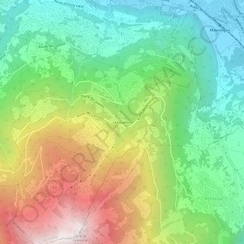
Name: Les Giettes topographic map, elevation, terrain.
Location: Les Giettes, Monthey, Valais, 1871, Suisse (46.20537 6.94235 46.24537 6.98235)
Average elevation: 3,343 ft
Minimum elevation: 1,302 ft
Maximum elevation: 6,683 ft
Other topographic maps
Click on a map to view its topography, its elevation and its terrain.