
Thank you for supporting this site ❤️
Make a donation
Make a donation
Gear up for your next adventure:
As an Amazon Associate, this site earns from qualifying purchases at no extra cost to you.
Cuajimoloyas topographic map
Click on the map to display elevation.
Thank you for supporting this site ❤️
Make a donation
Make a donation
Gear up for your next adventure:
As an Amazon Associate, this site earns from qualifying purchases at no extra cost to you.
About this map
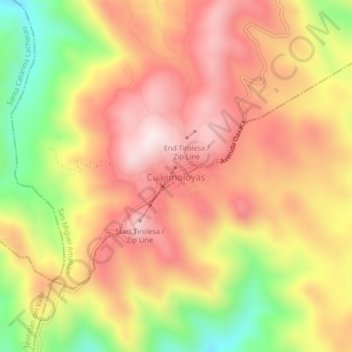
Name: Cuajimoloyas topographic map, elevation, terrain.
Location: Cuajimoloyas, San Miguel Amatlán, Oaxaca, Mexico (17.09889 -96.47250 17.13889 -96.43250)
Average elevation: 9,970 ft
Minimum elevation: 8,885 ft
Maximum elevation: 10,738 ft
Thank you for supporting this site ❤️
Make a donation
Make a donation
Gear up for your next adventure:
As an Amazon Associate, this site earns from qualifying purchases at no extra cost to you.