
Gatete topographic map
Interactive map
Click on the map to display elevation.
About this map
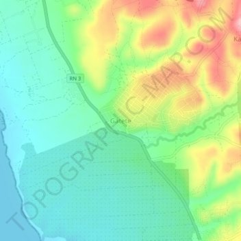
Name: Gatete topographic map, elevation, terrain.
Location: Gatete, Rumonge, Burundi (-4.06675 29.45847 -4.02675 29.49847)
Average elevation: 2,700 ft
Minimum elevation: 2,516 ft
Maximum elevation: 3,054 ft
Other topographic maps
Click on a map to view its topography, its elevation and its terrain.