
Thank you for supporting this site ❤️
Make a donation
Make a donation
Gear up for your next adventure:
As an Amazon Associate, this site earns from qualifying purchases at no extra cost to you.
Mornaula topographic map
Click on the map to display elevation.
Thank you for supporting this site ❤️
Make a donation
Make a donation
Gear up for your next adventure:
As an Amazon Associate, this site earns from qualifying purchases at no extra cost to you.
About this map
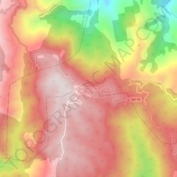
Name: Mornaula topographic map, elevation, terrain.
Location: Mornaula, Dhari, Nainital District, Uttarakhand, India (29.43160 79.75310 29.47160 79.79310)
Average elevation: 6,476 ft
Minimum elevation: 4,918 ft
Maximum elevation: 7,326 ft
Thank you for supporting this site ❤️
Make a donation
Make a donation
Gear up for your next adventure:
As an Amazon Associate, this site earns from qualifying purchases at no extra cost to you.