
Thank you for supporting this site ❤️
Make a donation
Make a donation
Gear up for your next adventure:
As an Amazon Associate, this site earns from qualifying purchases at no extra cost to you.
Talucco topographic map
Click on the map to display elevation.
Thank you for supporting this site ❤️
Make a donation
Make a donation
Gear up for your next adventure:
As an Amazon Associate, this site earns from qualifying purchases at no extra cost to you.
About this map
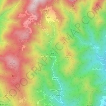
Name: Talucco topographic map, elevation, terrain.
Location: Talucco, Pinerolo, Torino, Piemonte, Italia (44.92857 7.27057 44.96857 7.31057)
Average elevation: 2,963 ft
Minimum elevation: 1,785 ft
Maximum elevation: 4,203 ft
Thank you for supporting this site ❤️
Make a donation
Make a donation
Gear up for your next adventure:
As an Amazon Associate, this site earns from qualifying purchases at no extra cost to you.