
Thank you for supporting this site ❤️
Make a donation
Make a donation
Gear up for your next adventure:
As an Amazon Associate, this site earns from qualifying purchases at no extra cost to you.
Cheb topographic map
Click on the map to display elevation.
Thank you for supporting this site ❤️
Make a donation
Make a donation
Gear up for your next adventure:
As an Amazon Associate, this site earns from qualifying purchases at no extra cost to you.
About this map
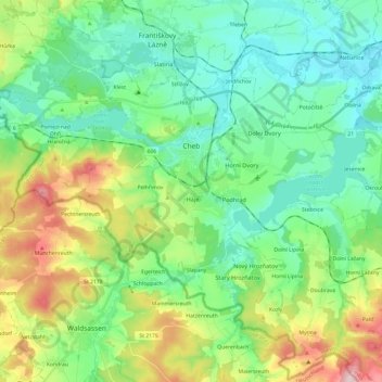
Name: Cheb topographic map, elevation, terrain.
Location: Cheb, Cheb District, Karlovy Vary Region, Northwest, Czechia (50.00081 12.24045 50.12085 12.48212)
Average elevation: 1,617 ft
Minimum elevation: 1,362 ft
Maximum elevation: 2,260 ft
Thank you for supporting this site ❤️
Make a donation
Make a donation
Gear up for your next adventure:
As an Amazon Associate, this site earns from qualifying purchases at no extra cost to you.