
Pathankot topographic map
Interactive map
Click on the map to display elevation.
About this map
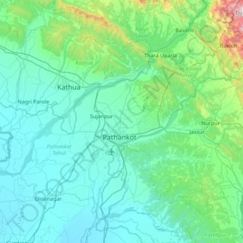
Name: Pathankot topographic map, elevation, terrain.
Location: Pathankot, Punjab, India (32.09287 75.32080 32.51118 75.93613)
Average elevation: 1,499 ft
Minimum elevation: 810 ft
Maximum elevation: 6,650 ft
Other topographic maps
Click on a map to view its topography, its elevation and its terrain.