Geolocate

Barawa topographic map

Click on the map to display elevation.

About this map

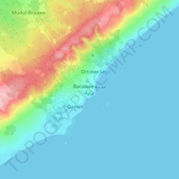
Name: Barawa topographic map, elevation, terrain.

Location: Barawa, Barawa District, Lower Shabelle, South West, Somalia (1.07278 43.99101 1.15278 44.07101)

Average elevation: 144 ft

Minimum elevation: -3 ft

Maximum elevation: 627 ft

Gear up for your next adventure:

🔊Portable Camp Speaker - Music and alerts at camp
🎒Trekking Poles - Sturdy poles for balance and stability on rough terrain
🕶️Glacier Sunglasses - Side shields to protect eyes from high-altitude snow glare
🌄Hiking Binoculars - Compact binoculars for scenic views and trail spotting
📷Action Cameras - Rugged cameras to document your journeys across rugged terrain

As an Amazon Associate, this site earns from qualifying purchases at no extra cost to you.