
Thank you for supporting this site ❤️
Make a donation
Make a donation
Gear up for your next adventure:
As an Amazon Associate, this site earns from qualifying purchases at no extra cost to you.
Nifontano topographic map
Click on the map to display elevation.
Thank you for supporting this site ❤️
Make a donation
Make a donation
Gear up for your next adventure:
As an Amazon Associate, this site earns from qualifying purchases at no extra cost to you.
About this map
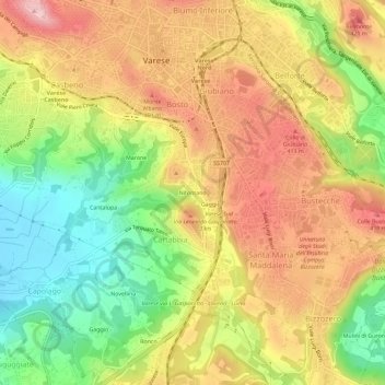
Name: Nifontano topographic map, elevation, terrain.
Location: Nifontano, Cartabbia, Varese, Lombardia, 21200, Italia (45.78381 8.81176 45.82381 8.85176)
Average elevation: 1,148 ft
Minimum elevation: 791 ft
Maximum elevation: 1,480 ft
Thank you for supporting this site ❤️
Make a donation
Make a donation
Gear up for your next adventure:
As an Amazon Associate, this site earns from qualifying purchases at no extra cost to you.